- Aboriginal History
- Cemeteries
- Hospitals
- Hotels
- Maps of the Goldfields
- Military
- Miners
- Miscellaneous
- People
- Places on the Goldfields
- Place Index A-Z
This website is dedicated to the memory of my two dear friends Sandy Duncan and Shyama Peebles who both passed away in 2012.
Sir Samuel / Mt Sir Samuel > Sir Samuel / Mt Sir Samuel
Sir Samuel Western Australia
SIR SAMUEL
Latitude 27° 38' S Longitude 120° 33' E
AKA Mt Sir Samuel
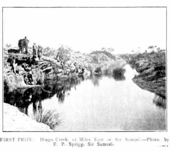
Dingo Creek Sir Samuel - Photo SLWA
The abandoned goldfields townsite of Sir Samuel is located 1011 km north east of Perth and about 40 km north north west of Leinster. Gold was first discovered in this area around 1895, and by 1896 it was regarded as likely to become an important mining centre, and a request was made to survey a townsite.
Following the selection of a site for the townsite, the Mining Warden for the area, A G Clifton suggested 3 possible names, Clifton after himself; Herberton after Herberts the original finder of gold in the area and Newmanton, after A W Newman, the surveyor. The Lands Department felt that the area was already too well known as Mt Sir Samuel, but the Mt. could be dropped from the name. This was agreed to, and the townsite of Sir Samuel was gazetted in 1897.
The townsite takes it's name from the nearby feature of Mount Sir Samuel, which was named by the explorer Lawrence Wells in February 1892. Wells was the surveyor in the Elder Exploring Expedition which had left from Adelaide the previous year, and he named Mount Sir Samuel after Sir Samuel James Way, Chief Justice and Lieutenant Governor of South Australia.
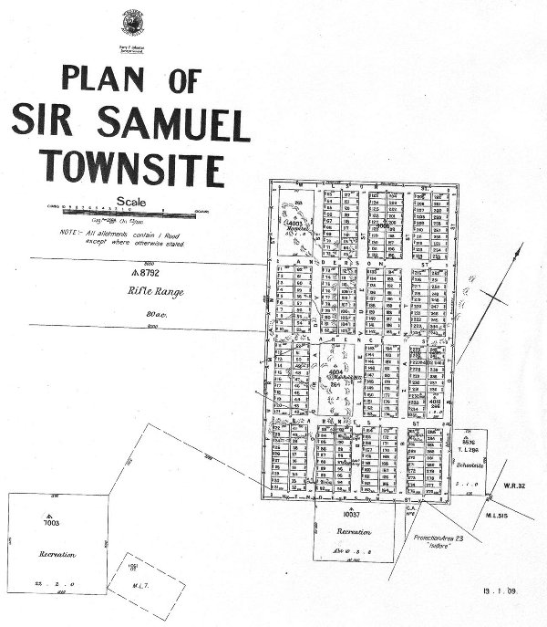
Street Map of Sir Samuel - Image SLWA
| Return to Sir Samuel / Mt Sir Samuel | Next Record Sir Samuel Cemetery |